
Kentucky Falls

Kentucky Falls Trail, located southeast of Mapleton, offers hikers a challenging 4.4-mile round-trip adventure through old-growth Douglas fir forest to view three spectacular waterfalls. According to the U.S. Forest Service, the trail descends 777 feet to an observation deck overlooking the 100-foot twin falls of Lower Kentucky Falls and North Fork Falls, with Upper Kentucky Falls visible about 0.8 miles into the hike.

Trail Summary

Trailhead: Approximately 19 Miles Southeast of Mapleton

Length: 4.4 miles Round Trip

Elevation: 777 ft. Descent From Trailhead to Lower Falls, 1540 ft. Ascent Back to Trailhead

Difficulty: Moderate

Surface Conditions: Dirt and Gravel, Roots and Rocks

Trailhead Directions and Access Points

The Kentucky Falls trailhead is accessible via two main routes, though the journey requires careful navigation on forest roads. From Eugene, take Highway 126 west for about 30.4 miles, then turn left onto Siuslaw River Road at the Whittaker Creek Recreation Area sign between mileposts 26 and 27. Follow a series of forest roads for approximately 17 miles, including Dunn Ridge Road, Knowles Creek Road, and Forest Service Roads #23 and #919, eventually reaching the parking area.Alternatively, from Reedsport, take US-101 North for 0.7 miles, then turn right onto Lower Smith River Road (Forest Road #48). After about 15.9 miles, turn left onto North Fork Smith River Road (Forest Road #48A), continuing for 10.6 miles before turning right onto Forest Road #23. Follow this for 9.6 miles, then turn left onto Forest Road #919 for the final 2.8 miles to the trailhead. Both routes require vehicles with good ground clearance due to the rugged forest roads. The trailhead features a parking area, restrooms, and picnic tables. It’s important to note that these roads may be impassable during winter months due to snow, making the trail most accessible from spring through fall.

Route Length and Elevation Gain

The Kentucky Falls Trail is a moderately challenging out-and-back hike with a total length of approximately 4.4 miles round trip. The trail descends through old-growth Douglas fir forest, dropping 777 feet in elevation from the trailhead to the observation deck at the lower falls. Hikers should be prepared for a strenuous uphill climb on the return journey. The highest point of the trail is at the trailhead, with an elevation of about 1,540 feet, while the lowest point is near the lower falls at approximately 836 feet. This elevation change provides a diverse hiking experience, offering both downhill and uphill sections that contribute to the trail’s moderate difficulty rating.

MAPLETON

Surface Conditions and Trail Maintenance

The Kentucky Falls Trail presents varying surface conditions that can challenge hikers, especially after winter storms or during periods of limited maintenance. The trail is primarily composed of dirt and gravel, with some sections featuring exposed roots and rocky terrain. According to recent trail reports, hikers may encounter downed trees, debris, and areas of trail tread damage, particularly following winter storms. The U.S. Forest Service notes that repair work is ongoing but limited due to staff constraints, and hikers should exercise caution. Some portions of the trail, especially between miles 5-6 when approaching from the North Fork Smith River side, may require extra care due to less frequent maintenance. Despite these challenges, the trail remains passable for experienced hikers who come prepared for potentially rough conditions. It’s advisable to check current trail conditions with the Oregon Dunes Visitor Center before embarking on the hike, as maintenance status can change seasonally.

Sources:

Siuslaw Forest Service, Eugene Cascades & Coast, Gaia GPS

Oregon Hikers, Hike Oregon, All Trails

Related Articles

Biking, Events, Outdoors, Sports & Wildlife

Lane County Wildfire Risk, Lane County

Lane County Wildfire Risk Map: 2026 Updates for Foothills

by | Oct 16, 2026 | Community, News, Public Service | 0 Comments

Published October 16, 2026 The 2026 Eugene-Springfield Metro Community Wildfire Protection Plan identified the highest-risk wildfire zones in the metro area,...

Dexter Reservoir Trail:, Lane County

Dexter Reservoir Trail

by | Oct 15, 2026 | Local Attractions, Outdoors, Parks & Recreation | 0 Comments

Published October 15, 2026 The Dexter Reservoir area featured a riverside trail extending approximately 5 miles from the Dexter Dam to Elijah Bristow State Park. The...

Eugene Smoke Alarms: How to Get Safety Help

by | Oct 15, 2026 | Home Maintenance, How To, Public Service | 0 Comments

Published October 14, 2026 Eugene Springfield Fire provides extensive public education on smoke alarm types and placement to keep residents safe. While they offer...

Ninkasi Brewing:, Lane County

Ninkasi Brewing: Eugene’s Original Craft Brewery on Shadow Lane

by | Oct 13, 2026 | Business, Community, Food & Drink, Spotlight | 0 Comments

Published October 13, 2026 Ninkasi Brewing Company is a Eugene-based microbrewery founded in 2006 by Jamie Floyd and Nikos Ridge in the Whiteaker neighborhood. It is...

Eugene Public Library Expansion: Fall 2026 Construction Update

by | Oct 13, 2026 | Community, News, Public Service | 0 Comments

Published October 12, 2026 There is currently no verified information regarding a specific expansion or construction project for the Eugene Public Library in Fall 2026....
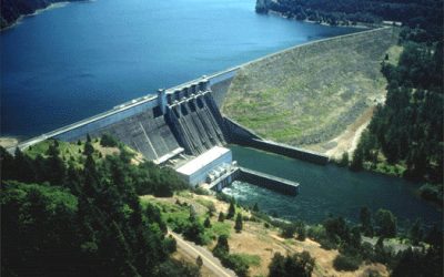
Lookout Point Lake Trail: An Easy Reservoir Walk East of Cottage

by | Oct 12, 2026 | Local Attractions, Outdoors, Parks & Recreation | 0 Comments

Published October 11, 2026 Lookout Point Lake in Lowell, Oregon, features the easy North Shore Trail along its reservoir. Visitors can enjoy year-round fishing,...

Lane County Hazardous Waste, Lane County

How to Schedule a Lane County Household Hazardous Waste Drop-Off

by | Oct 10, 2026 | Home Maintenance, How To, Public Service | 0 Comments

Published October 10, 2026 Lane County residents can schedule free household hazardous waste drop-offs at the Glenwood Transfer Station in Eugene. Appointments are made...

Lane County Valentine S: — Lane County Valentine S, Lane County

Lane County Valentine’s Day: 2027 Romantic Ideas

by | Oct 9, 2026 | Events, Food & Drink, Local Attractions | 0 Comments

Published October 9, 2026 Valentine's Day 2027 falls on February 14, offering opportunities for romantic dining in Eugene and winter getaways in the Willamette Valley....

King Estate Winery:, Lane County

King Estate Winery: A Hilltop Tasting Room South of Eugene

by | Oct 9, 2026 | Business, Food & Drink, Spotlight | 0 Comments

Published October 8, 2026 King Estate Winery is a Biodynamic-certified estate located on 1,033 acres southwest of Eugene. It features a tasting room, an on-site...

Lane County Housing: — Lane County Housing, Lane County

Lane County Housing: 2026 Waitlist Status Recap

by | Oct 7, 2026 | Community, News, Public Service | 0 Comments

Published October 7, 2026 As of October 2026, all tracked waitlists at the Housing Authority & Community Services of Lane Co (HACSA) remained closed to new...
Lane County Holiday Markets, Lane County

Lane County Holiday Markets 2026: Dates, Locations, and What

by | Oct 7, 2026 | Community, Events, Local Attractions | 0 Comments

Published September 28, 2026 The primary holiday market in Lane County for 2026 is the Eugene Saturday Market Holiday Market held at the Lane Events Center. It runs on...

Lane County Burn Permit, Lane County

How to Get a Lane County Burn Permit for Fall Debris Burning

by | Oct 5, 2026 | Home Maintenance, How To, Public Service | 0 Comments

Published September 29, 2026 Outdoor burning in Lane County is regulated by the Lane Regional Air Protection Agency (LRAPA). Residential debris burning typically occurs...
Lane County Parks Shelters:, Lane County

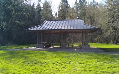
Lane County Parks Shelters: How to Reserve

by | Oct 5, 2026 | How To, Parks & Recreation, Public Service | 0 Comments

Published October 2, 2026 Lane County Parks picnic shelters and day use group sites are reserved online through the official county reservation portal. A non-refundable...
Lane County: Mud Season, Lane County

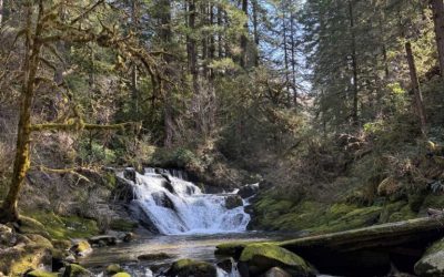
Late Winter 2027 in Lane County: Mud Season Hikes and Cozy Getaways

by | Sep 16, 2026 | Local Attractions, Outdoors, Parks & Recreation | 0 Comments

Published September 16, 2026 Late winter in Lane County offers diverse hiking options including the multi-tiered falls of Sweet Creek and the summit of Spencer Butte....
Lane County Cabins, Lane County

Lane County Cozy Cabins and Lodge Getaways for Winter 2026/27

by | Sep 12, 2026 | Community, Local Attractions, Outdoors | 0 Comments

Published September 12, 2026 Lane County offers a variety of winter retreats, including the highly-rated Gorgeous Pacific Northwest Private Lodge in Southeast Eugene...

Falling Sky Brewing:, Lane County

Falling Sky Brewing: A Eugene Brewery Built Around Local Grain

by | Sep 11, 2026 | Business, Community, Food & Drink, Spotlight | 0 Comments

Published September 11, 2026 Falling Sky Brewing is a Eugene-based microbrewery founded in 2012 that focuses on local Oregon-grown ingredients and farm-to-pint...

Fall Creek Falls Trail:, Lane County

Fall Creek Falls Trail: A Quiet Cascade on the Middle Fork

by | Sep 10, 2026 | Local Attractions, Outdoors, Parks & Recreation | 0 Comments

Published September 10, 2026 The Fall Creek Falls Trail was a family-friendly 2. Fall Creek Falls Trail: Fall Creek Falls Trail — Lane County, Oregon The Fall Creek...

Eugene Urban Winery: — Eugene Urban Winery, Lane County

Eugene Urban Winery: Territorial Vineyards Recap

by | Sep 7, 2026 | Business, Food & Drink, Spotlight | 0 Comments

Published September 7, 2026 Territorial Vineyards & Wine Company is an urban winery located in Eugene's Whiteaker neighborhood. They feature Willamette Valley...

Eugene Bulky Waste, Lane County

How to Schedule Bulky Waste Pickup in Eugene

by | Sep 6, 2026 | Home Maintenance, How To, Public Service | 0 Comments

Published September 5, 2026 Residents in Eugene schedule bulky waste pickup by contacting one of the city's licensed haulers, such as Sanipac or Royal Refuse....
Salt Creek Falls Overlook:, Lane County

Salt Creek Falls Overlook: Quick Highway 58 Stop

by | Sep 6, 2026 | Local Attractions, Outdoors, Parks & Recreation | 0 Comments

Published September 6, 2026 Salt Creek Falls Overlook is a short trail in the Willamette National Forest featuring a 286-foot single-drop waterfall. Located off Highway...